I think if we had planned the trip to Bolivia in much more detail, it probably wouldn't have been as great as it was. I really liked the idea of having an itinerary subject to what we felt like doing at the time, because almost everything we did was improvisation with very good results. During our stop in the town of Samaipata we didn't have much of an idea of which places to go and explore, but the options were not long in coming. One of them was to go and do some trekking in the most special place in the area, and when we saw the location on the map, we quickly understood why 😃.
Creo que si hubiésemos planeado el viaje a Bolivia con mucho más detalle, seguramente no habría sido tan genial como lo fue. Eso de tener un itinerario sujeto a lo que tuviéramos ganas de hacer en el momento me gustó mucho, porque casi todo lo que hicimos fue improvisación con muy buenos resultados. Durante nuestra parada en el pueblo de Samaipata no teníamos mucha idea de qué lugares ir a explorar, pero las opciones no tardaron en llegar. Una de ellas fue ir a hacer un poco de trekking en el lugar más especial de la zona, y cuando vimos la ubicación en el mapa, rápidamente entendimos el por qué 😃.
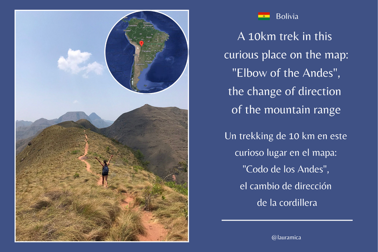
In Samaipata we stayed three nights in a nice hostel in the middle of the mountains. This was the longest stop we made in one place: after days of constant moving around, we needed at least a bit of calm. The first day we arrived quite late at night, but then we had two full days to do something. The first thing the owner of the hostel recommended us was to go to the so called Elbow of the Andes, the most popular trekking there. When we asked why it was called that, he told us to check the map and we would find out 😃.
En Samaipata nos hospedamos tres noches en un lindo hostel en medio de la montaña. Esta fue la parada más larga que hicimos en un mismo lugar: después de días de estar moviendonos constantemente, necesitábamos al menos un poco de calma. El primer día llegamos bastante tarde en la noche, pero luego teníamos dos días enteros para hacer algo. Lo primero que nos recomendó el dueño del hostel fue ir hasta el llamado Codo de los Andes, el trekking más popular ahí. Cuando preguntamos el por qué de ese nombre, nos dijo que revisaramos el mapa y lo descubriríamos 😃.
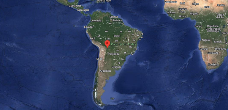
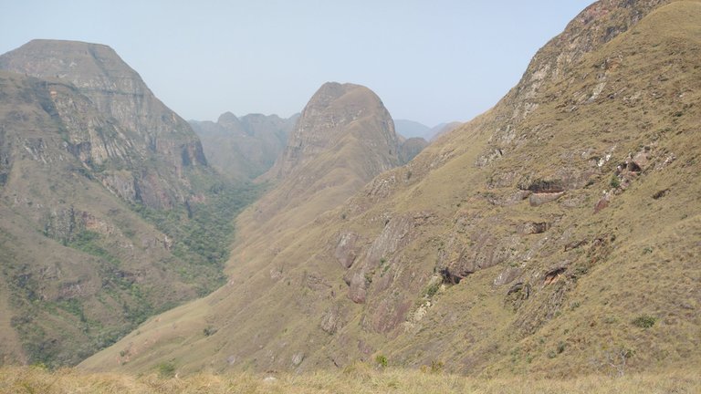
Location of Codo de Los Andes (Andes Elbow): do you notice the angular shape of this area?
Ubicación de Codo de Los Andes: ¿notas la forma en ángulo de esta área de la cordillera?
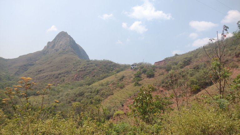
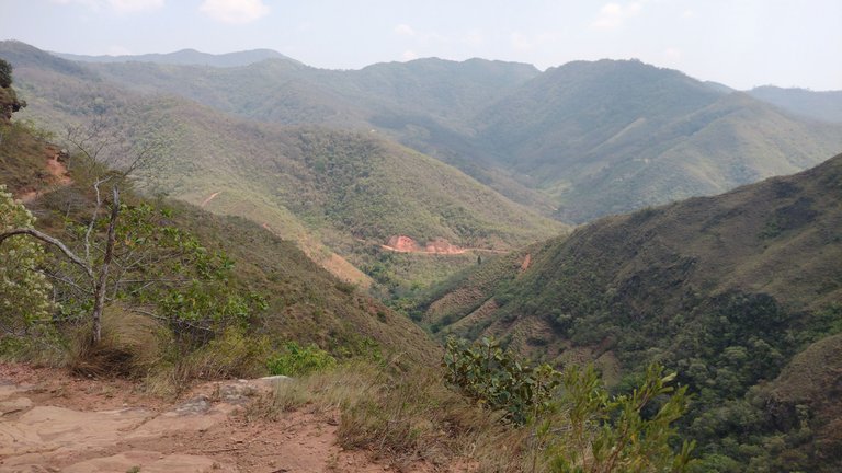
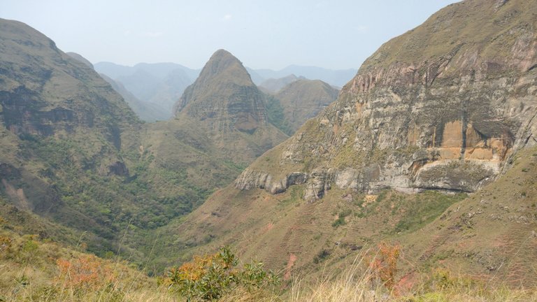
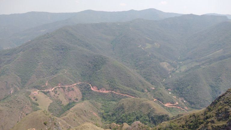
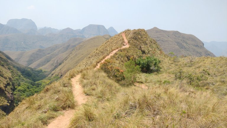
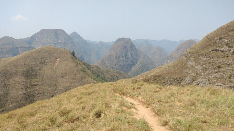
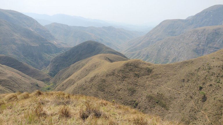
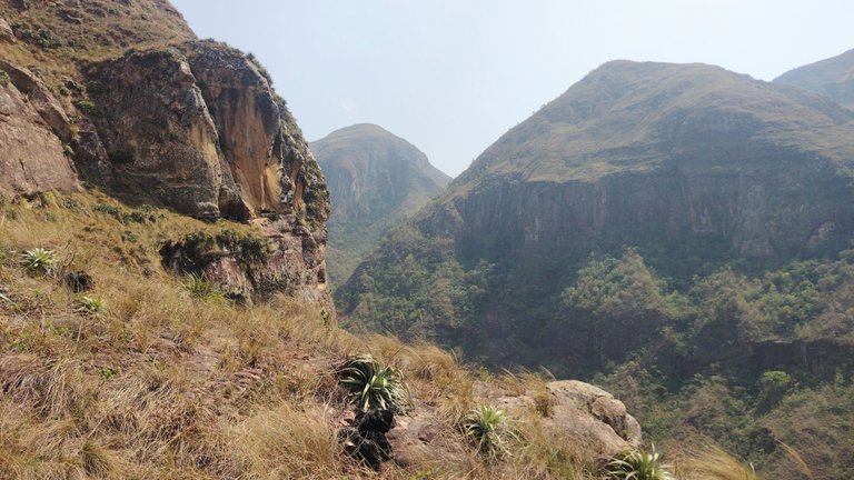
The place for the trekking was just at the point where the Andes mountain range bends. Looking at the relief map, this location looked great. It was a 10 km hike over the local mountains, with a trail that started in the mountains and ended at some waterfalls. This route was not circular, i.e. it started on a gravel road and ended on the road about 5 km further on, so the best option was to take a taxi there and back, despite having your own vehicle 😃.
El lugar del trekking era justo en la parte en donde dobla la Cordillera de Los Andes. Mirándolo en el mapa con relieve, esta ubicación se veía genial. Se trataba de una caminata de 10 km por encima de las montañas del lugar, con un sendero que empezaba monte adentro y que terminaba en unas cascadas. Esta ruta no era circular, es decir, empezaba en una calle de ripio y finalizaba en la ruta como 5 km más adelante, por lo que la mejor opción fue ir y volver el taxi, a pesar de tener vehículo propio 😃.
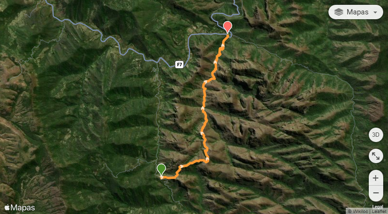
Route on Wikiloc, starting on a gravel road (green mark) and ending on route 7 (red mark).
Ruta en Wikiloc, empezando en calle de ripio (marca verde) y finalizando en la ruta 7 (marca roja).
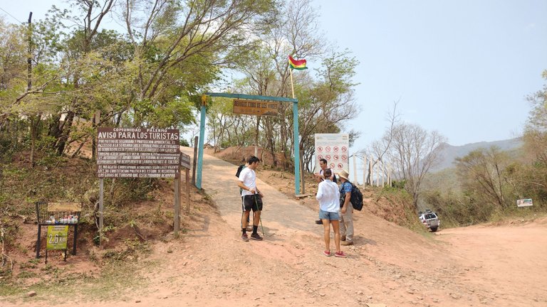
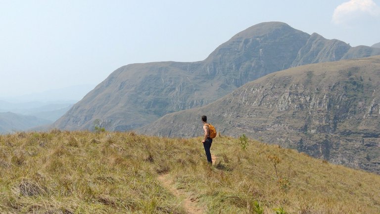
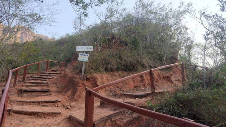
The taxi dropped us off right at the beginning of the trail and there we found everything the hostel owner had told us about. There was a checkpoint where we checked in and were offered to hire a local guide if we wanted to get to the waterfalls. Supposedly this was one of those treks that can only be done with a guide, but we had read on the internet that the trail was well marked so you could do it on your own. To get around this, Guest M said that we would only go up to the viewpoint, about 2 km further on, and then return. I think that was the first time he lied about anything on this trip, he is too correct 😂.
El taxi nos dejó justo en el inicio del sendero y ahí nos encontramos con todo lo que el dueño del hostel nos había indicado. Había un puesto de control en donde nos hicieron registrarnos y nos ofrecieron contratar a un guía local si queríamos llegar hasta las cascadas. Supuestamente este era uno de esos trekkings que solo se pueden hacer con guía, pero habíamos leido en internet que el sendero estaba perfectamente señalizado como para hacerlo por tu cuenta. Para zafar de esto, Huésped M dijo que solo subiríamos hasta el mirador, unos 2 km más adelante y que luego regresaríamos. Creo que fue la primera vez que mintió en algo en este viaje, él es demasiado correcto 😂.
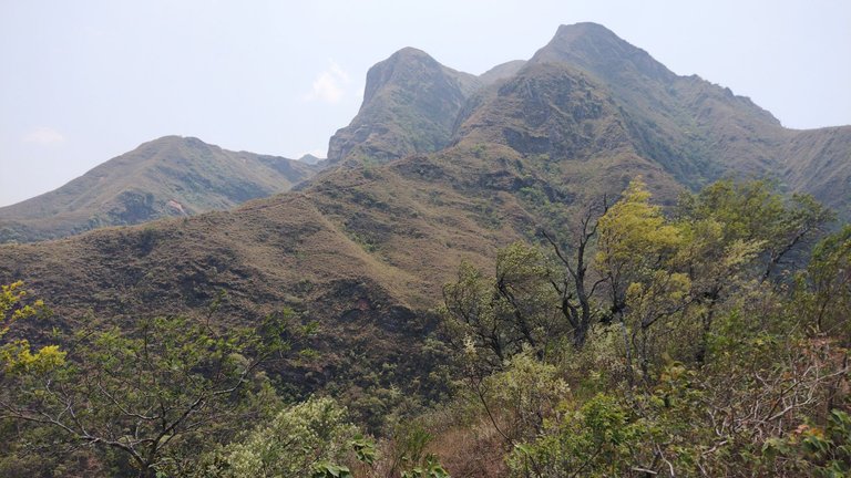

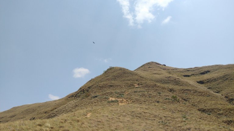
The beginning of the trail already started very intensely, with a steep climb in a mini-track through the pastures. Just like the previous days, it was midday and already hot as hell, so we had to constantly hydrate ourselves and put on lots of sunscreen. I had almost forgotten what it was like to trek in the heat, and I didn't like to remember it, but I wanted to live the experience. As for the altitude, this place averages 1500 masl, so we didn't feel any discomfort from that 😃.
El principio del sendero ya comenzó de manera muy intensa, con una subida abrupta en una mini-huella entre los pastos. Tal cual los días anteriores, era mediodía y ya hacía un calor infernal, por lo que teniamos que hidratarnos constantemente y ponernos mucho protector solar. Yo ya casi había olvidado lo que era hacer trekking con calor, y no me gustó recordarlo, pero quería vivir la experiencia. En cuanto a la altura, este lugar tiene un promedio de 1500 msnm, así que no sentimos ninguna molestia por eso 😃.
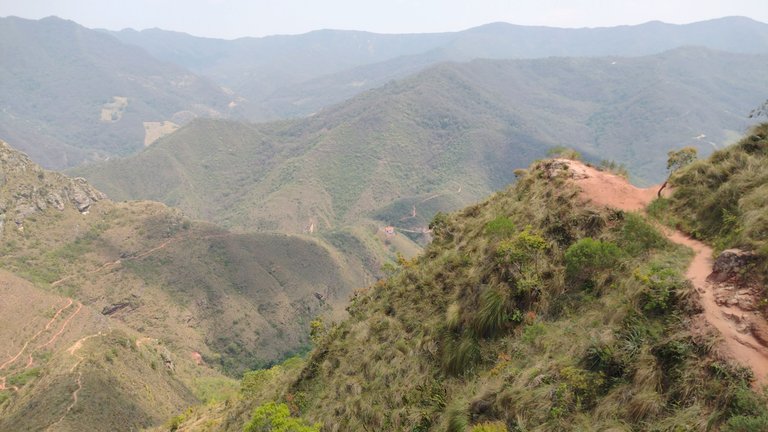
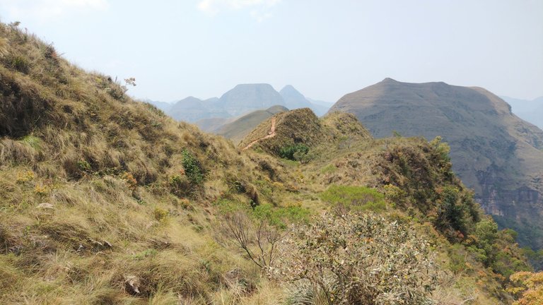

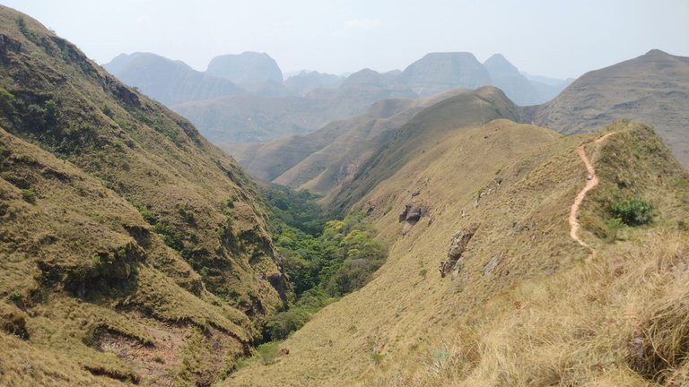
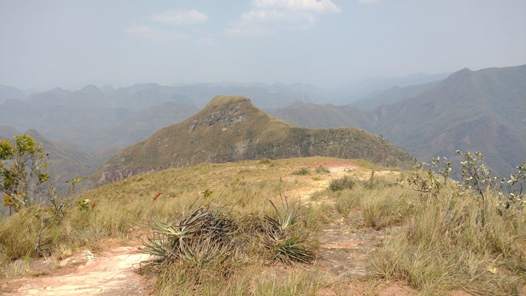
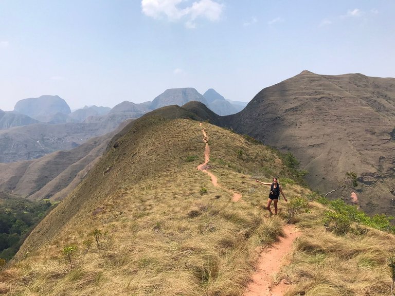
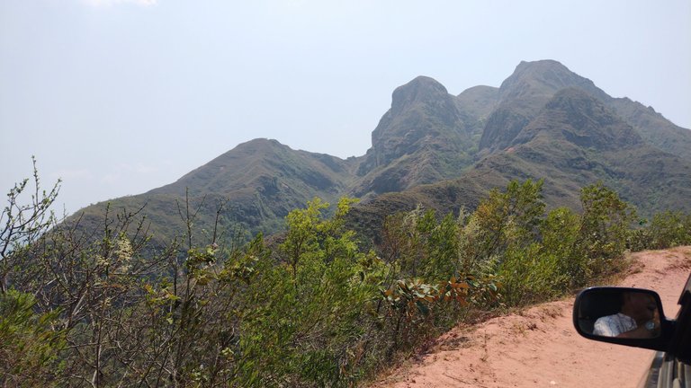
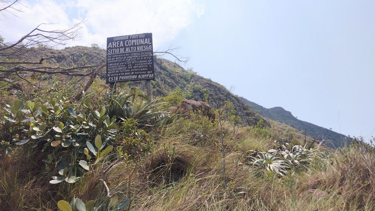
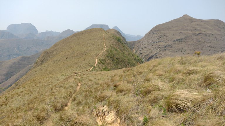
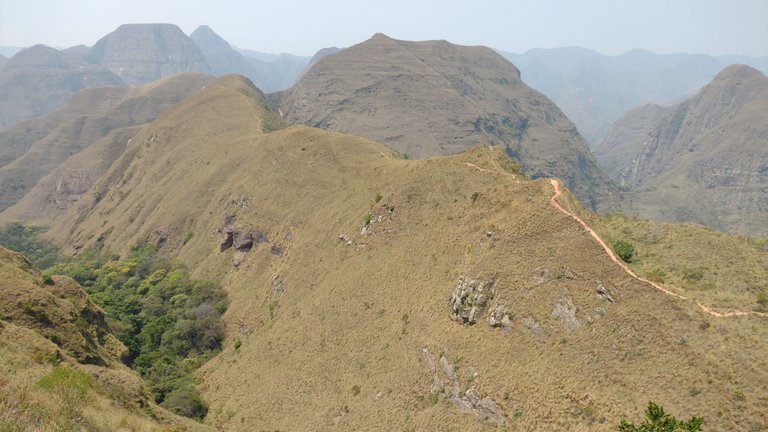
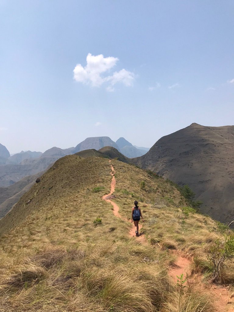
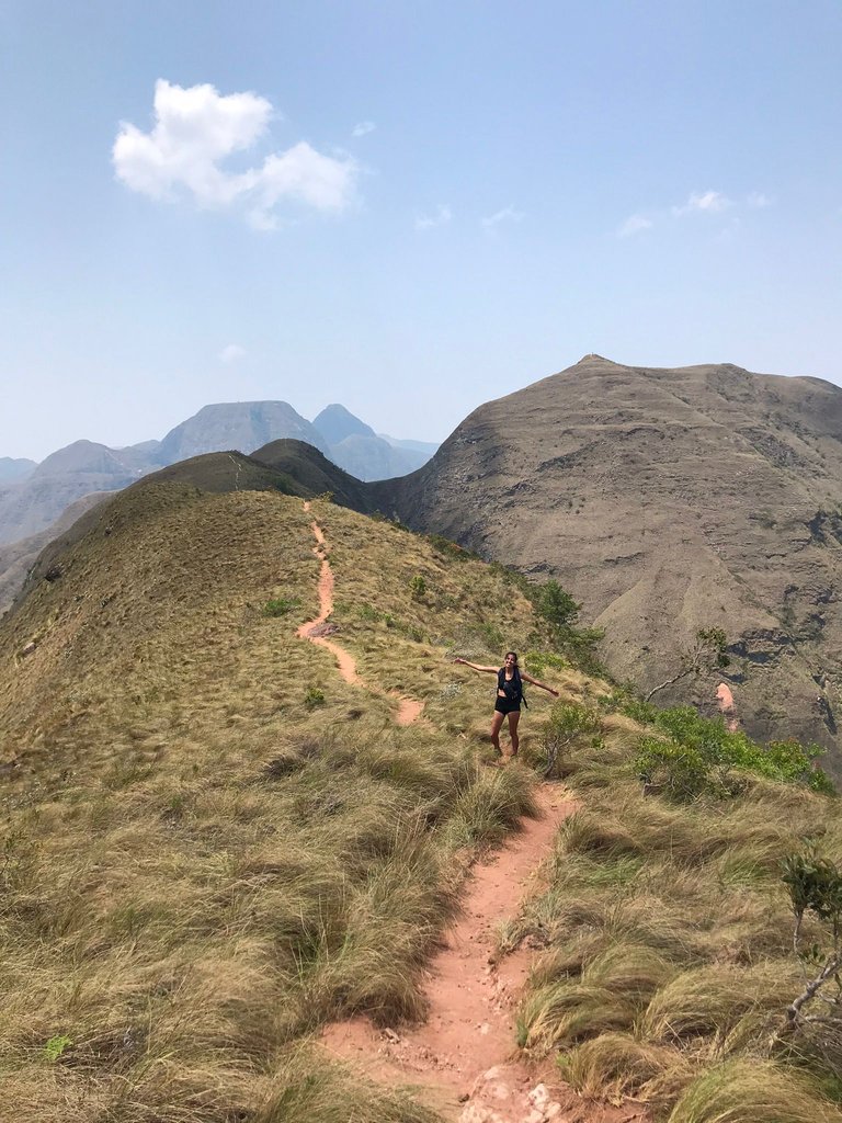
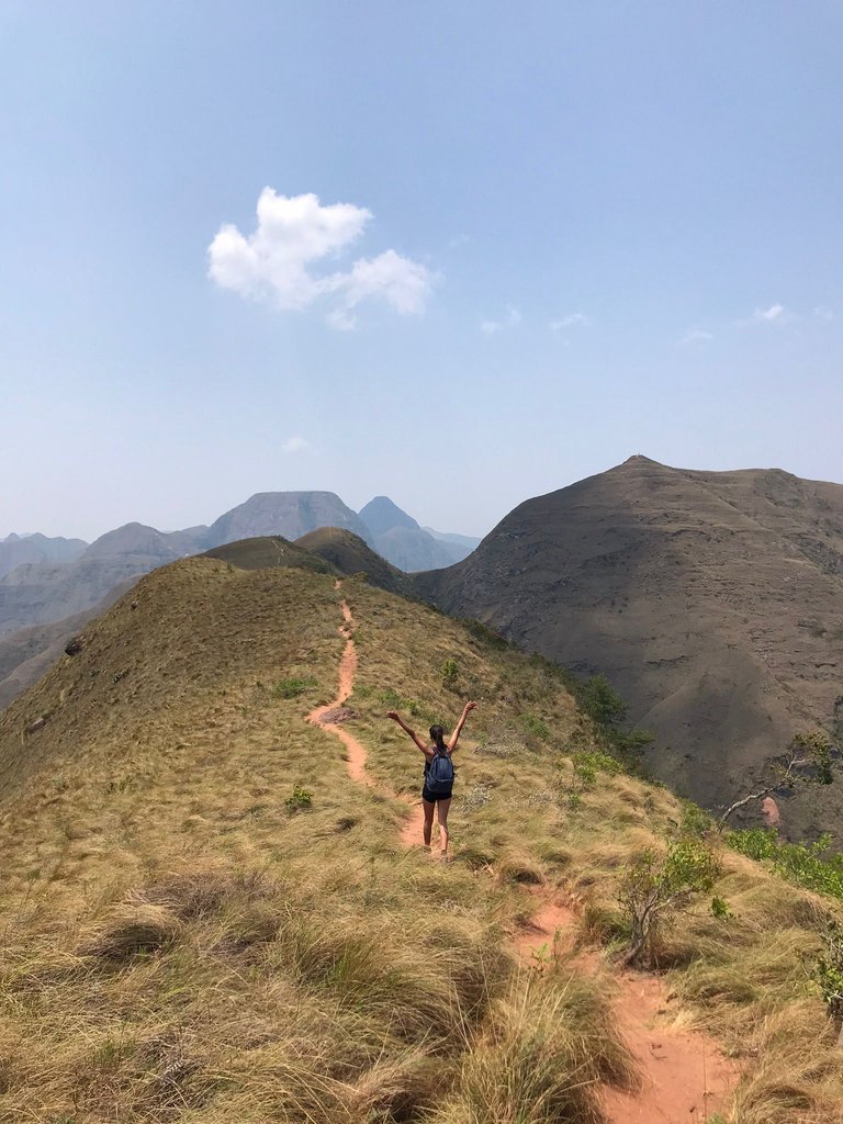
The best thing about a steep trailhead is that it allows you to gain altitude quickly and the views we had from there were absolutely incredible. Everything around looked like something out of a science fiction movie, with those landscapes that you don't know if they exist or not. From up there you could clearly see which way to go, and although it wasn't specifically signposted, it was very intuitive. For the moment, the guide seemed not to be necessary 😃.
Lo mejor de un inicio de sendero empinado es que te permite ganar altura rápidamente y las vistas que teníamos desde ahí eran completamente increíbles. Todo alrededor se veía como de una película de ciencia ficción, con esos paisajes que no sabes si existen o no. Desde ahí arriba se podía ver claramente cuál era el camino a seguir, y a pesar de no estar señalizado específicamente, era muy intuitivo. Por el momento, el guía parecía no ser necesario 😃.
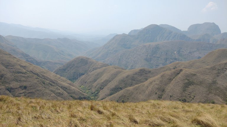

Samaipata is a village just like the ones I like, somewhat small and surrounded by mountains. This combination allows you to have the best of both worlds, without sacrificing comfort or nature. But the landscapes of Samaipata surprised us because it was a contrast to everything we had seen so far. In all our previous stops, we were surrounded by arid and barren landscapes, while in this town the vegetation and mountains turned bright green. This change indicated that we were already approaching a wetter part of the country, but unfortunately not a cooler one 😅.
Samaipata es un pueblo justo como los que me gustan, algo pequeños y rodeados de montañas. Esta combinación te permite tener lo mejor de ambos mundos, sin sacrificar comodidad o naturaleza. Pero los paisajes de Samaipata nos sorprendieron porque fue un contraste con todo lo que veníamos viendo hasta el momento. En todas nuestras paradas anteriores, estuvimos rodeados de paisajes áridos y anarajados, mientras que en este pueblo la vegetación y las montañas se volvieron verde intenso. Este cambio nos indicaba que ya nos estábamos acercando a una parte más húmeda del pais, pero lamentablemente no más fresca 😅.
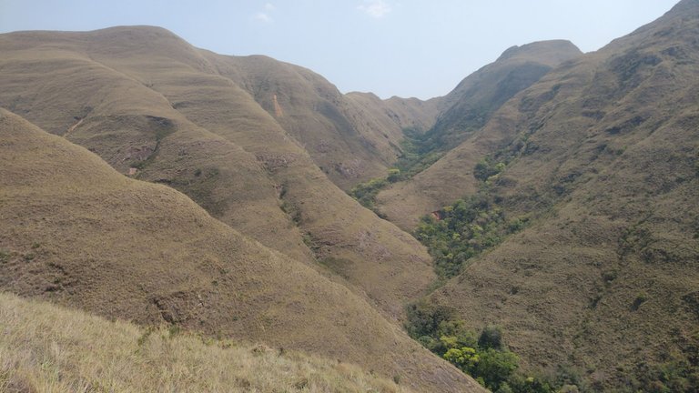
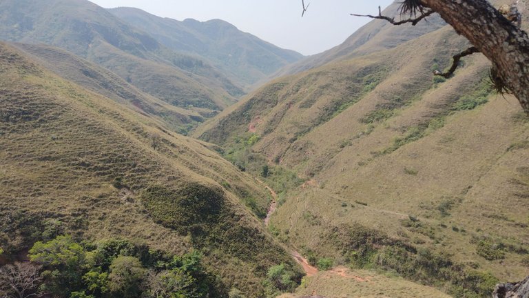
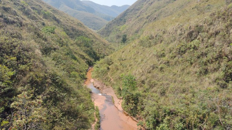
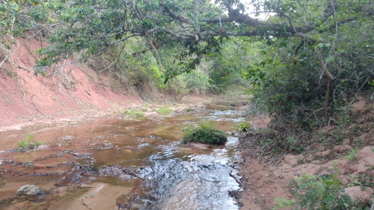
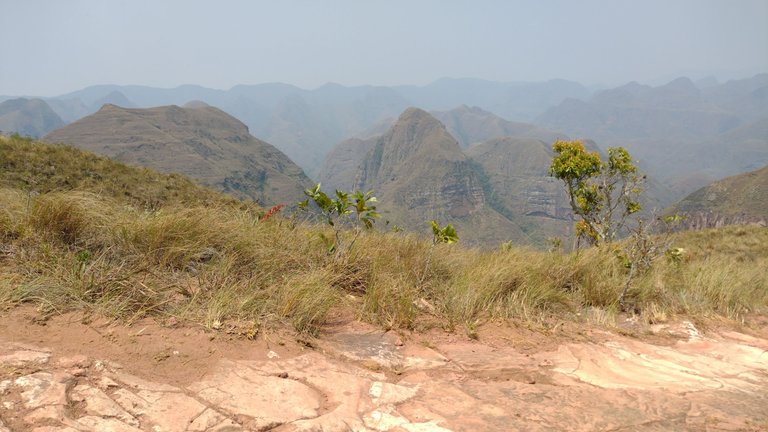
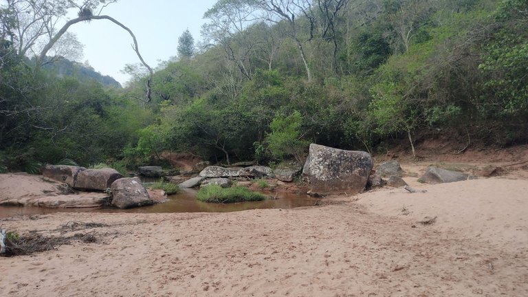
In our entire 10 km journey along the Elbow of the Andes we only stopped once for lunch and refreshment by the river. As you can see in the pictures, 80% of the way there was not even a shadow to sit and rest for a while. It was only when we were finishing the trail and approaching the water that we saw a bit more tall vegetation. For the heat we were having this was a relief, although it was bad for the trail because in this part there was no longer the track that we had been following calmly. I think the guide would have been useful only at that point 😅.
En todo nuestro camino de 10 km por el Codo de los Andes solo hicimos una parada para almorzar y refrescarnos al costado del río. Como pueden ver en las fotos, en el 80% del camino no hubo ni una sombra para sentarse a descansar un rato. Recién cuando estábamos terminando el sendero y nos acercamos al agua, vimos un poco más de vegetación alta. Para el calor que teníamos esto fue un alivio, aunque a nivel sendero fue malo porque en este parte ya no estaba la huella que veníamos siguiendo tranquilamente. Creo que solo en ese momento hubiese sido útil el guía 😅.
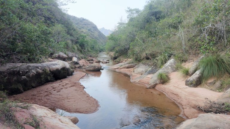
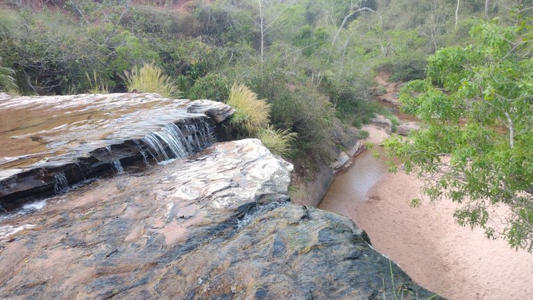
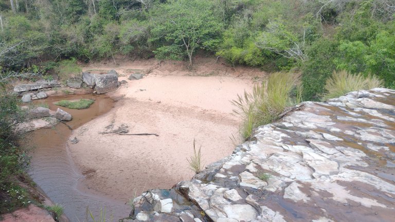
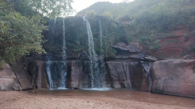
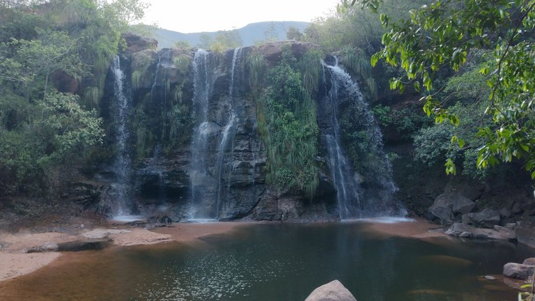
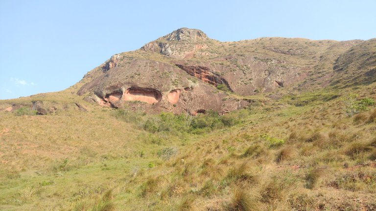
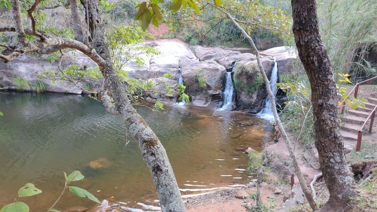
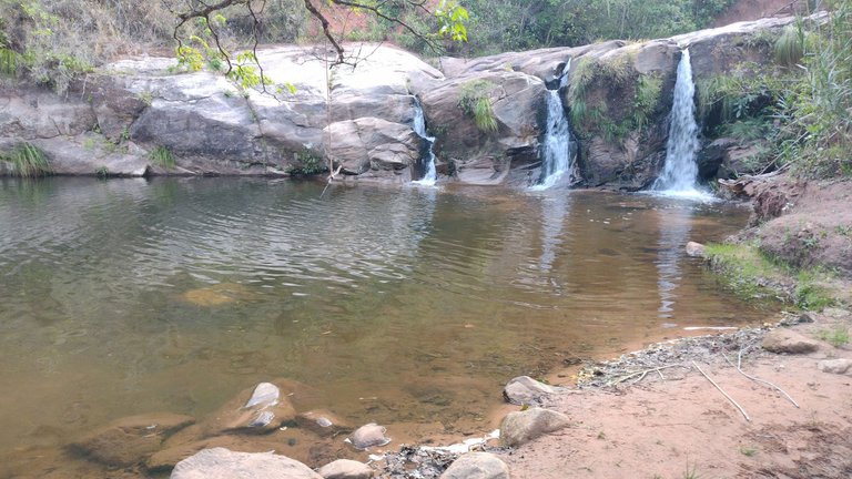
However, we knew that the path led to some waterfalls, so we walked all along the river bank and that was it. It sounds easy to say, but it wasn't easy to do because at times the river was landlocked and we had to climb over small cliffs on the sides. The ground was very clayey, so walking on top of the water was not always an option, although at times we did that too. After a while of wild expedition, we finally reached the famous waterfalls. To our surprise, this place was like an armed spa, but it was either closed or abandoned. It looked pretty good, so we didn't understand why it was in disuse. Anyway, this was the best thing for us because we could enjoy the whole place freely. Literally in the 8 hours that this walk lasted we didn't meet any other person except at the entrance of the trail, it is clear that nobody wanted to pay for the guide that day 😂.
Sin embargo, sabíamos que el camino desembocaba en unas cascadas, así que caminamos todo por la orilla del río y listo. Suena fácil decirlo, pero no fue hacerlo porque por momentos el río no tenía costa y tuvimos que treparnos por pequeños precipicios de los costados. El suelo era muy arcilloso, por lo que caminar encima del agua no siempre fue una opción, aunque por tramos también lo hicimos. Después de un rato de expedición salvaje, finalmente llegamos a las famosas cascadas. Para nuestra sorpresa, este lugar era como un balneario armado, pero que estaba cerrado o abandonado. Se veía bastante bien, así que no entendimos por qué estaba en desuso. De cualquier forma, esto fue lo mejor para nosotros porque pudimos disfrutar de todo el lugar libremente. Literalmente en las 8 horas que duró este paseo no nos cruzamos con ninguna otra persona salvo en la entrada del sendero, se ve que nadie quiso pagar el guía ese día 😂.
After having a good time at the waterfalls, refreshing ourselves and finally having our post walk picnic, it was time to leave. Of course, being a closed park, the entrance gate was also closed and we had to jump over the wire fences on the sides of the park like a bunch of bumbling insects. Well, after all, that's what we were. Surely if we had gone with a guide, he would have had the key to the gate so that we could get out more comfortably. Yes, we would have got out more easily, but then I wouldn't be able to tell that while I was in the Elbow of the Andres I finished the trek with a bit of climbing 🙂.
Después de haber pasado un buen rato en las cascadas, refrescándonos y finalmente teniendo nuestro picnic post caminata, llegó el momento de irnos. Claro, al ser un parque cerrado, el portón de ingreso también lo estaba y tuvimos que saltar el alambrado de los costados como unos instrusos. Bueno, después de todo, eso éramos. Seguramente si hubiésemos ido con un guía, él hubiese tenido la llave de la puerta para poder salir más cómodamente. Sí, hubiésemos salido más fácilmente, pero entonces yo hoy no tendría para contar que mientras estuve en el Codo de los Andres finalicé el trekking con un poco de escalada 🙂.
❤️ Hope you liked this post! Thanks for reading. ❤️
❤️¡Espero que les haya gustado este post! Gracias por leer. ❤️
 |  |  |
|---|
Lau 💕.
📸 Portada creada en Canva. Todas las imágenes son de mi propiedad 💕.
I'm curious, there's no vegetation up in the mountains, but in the middle of the mountains there is, a curious ecosystem. Nice post
This place is really weird, hahaha, it reminded me of the landscapes from the movie Avatar 😅.
Hey @lauramica
Your 10 km trek through Bolivia's 'Elbow of the Andes' is inspiring! The unique change in the mountain range's direction must have offered breathtaking views. Your photos beautifully capture the diverse landscapes and the essence of this curious place. Thank you for sharing this remarkable adventure.
Glad that you liked it 😃!
You can check out this post and your own profile on the map. Be part of the Worldmappin Community and join our Discord Channel to get in touch with other travelers, ask questions or just be updated on our latest features.
Congratulations @lauramica! You have completed the following achievement on the Hive blockchain And have been rewarded with New badge(s)
Your next target is to reach 1600 posts.
You can view your badges on your board and compare yourself to others in the Ranking
If you no longer want to receive notifications, reply to this comment with the word
STOPIt sounds like an incredible adventure, with just the right mix of spontaneity and challenge! The landscape of Samaipata and the Elbow of the Andes seems breathtaking, especially with the sharp contrast in scenery. The trek itself must have been exhausting under the heat, but those waterfalls at the end made it all worth it! It's funny how avoiding a guide led to an even wilder experience, with unexpected climbs and a deserted spa waiting at the finish line.
Yes, this place was really amazing ❤️!
What an amazing adventure trip, sis, the place is very beautiful, the natural scenery is truly amazing ❤️
Yes, thank you 💕
You're welcome, sis❤️
Travel Digest #2499.
Become part of our travel community:
- Join our Discord
Hiya, @ybanezkim26 here, just swinging by to let you know that this post made it into our Honorable Mentions in Your post has been manually curated by the @worldmappin team. If you like what we're doing, please drop by to check out all the rest of today's great posts and consider supporting other authors like yourself and us so we can keep the project going!wooo que gran aventura y caminata :D
Siiiiii.
@lauramica, I paid out 0.746 HIVE and 0.182 HBD to reward 2 comments in this discussion thread.
Qué excelente colección de fotos, muy bueno en verdad. Los paisajes muy verdes con montañas o colinas son mis vistas favoritas.
Es una pena que no se hayan construido paradas para los caminantes, que se puedan cubrir un rato del sol.
Eso creo que sería un agregado genial, es un paseo en la naturaleza cierto, pero un kiosco o dos para hacer paradas vendría muy bien.
Hola! Si, la verdad que unos descansitos con sombra no hubiesen estado nada mal jajaja. Pero la naturaleza era muy hermosa, me gustaba que no sea tan habitada por la gente.
Gracias por pasar, saludos ❤️.